August to December 1900
Excerpted from USGS Reports
The Gold Belt of the Blue Mountains
of Oregon
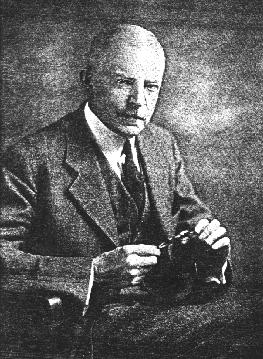
by Waldemar Lindgren
Concentrations on Bedrock and In Gravels
--Extent of the Placer Deposits--
An Historical Overview
The placer deposits indicate the extent of the gold belt of Eastern Oregon, being widely scattered over the whole area, from the sands of the Snake River on the east to the gravel bars of John Day River on the west. They were the first deposits discovered by the pioneer miners and yielded their millions in early days. Though the output is greatly diminished, the placers are at the present time by no means an unimportant factor in the gold-mining industry of the State.
The placer-mining districts are distributed as follows: On the east the Snake River bars still contribute some fine gold. In the Eagle Creek Mountains and at Sparta a small but steady production is maintained. Sparta, especially, was noted for its rich gulch diggings in early times. The Belt extending from Connor Creek by Weatherby, Chicken Creek, Rye Valley, Humbolt, Clarks Creek, and Malheur was formerly the most important gold-mining region in the State and still maintains a diminishing production.
The Virtue placers, near Baker City, were long ago exhausted. West of Baker City is the gold belt of the southern Elkhorn Range, with the once celebrated camps of Auburn, Pocahontas, and Minersville. The headwaters of Powder and Burnt rivers, as well as those of Granite Creek, including the districts of Sumter, Granite, Robinsonville, Bonanza, Gimlet, may be said to form the central placer-mining region of the Blue Mountains. These placers, while not as extraordinarily rich as some of the others, have maintained a steady though small production, and seem likely to continue to do so for many years. Finally, on the western side are found the isolated districts of Susanville, Dixie Creek, and Canyon Creek, the latter having the reputation of having been the richest placer camp in the State. Both at Susanville and at Canyon a fairly steady production is maintained. Farthest west are the small placers of Fox Creek and Spanish Gulch, on Crooked River, the latter locality 60 miles west-southwest of Canyon.
With few exceptions the placers are gravel deposits contained in the beds of the present streams and gulches, or bars or benches deposited by the same water courses at a former higher level; the benches are rarely found more than 200 feet above the present stream bed; most frequently they are 50 to 100 feet above the same. The depth of the gravels seldom exceeds 50 feet and is ordinarily much less. The bed rock may be any one of the formations found in the region. In mountains which have been covered by glaciers during the ice epoch placers are rarely found. Examples of this are found in the Cornucopia, Cable Cove, and Greenhorn districts. No doubt the gold-bearing gravels existed there before the advance of the ice streams. But the latter have dislodged the gravels and scattered the gold among the moraines and the time since the close of the Glacial epoch has been too short to permit a new concentration of the gold. As a rule, in these districts placers are found below the terminal moraines. All this means that the placers were chiefly deposited by the present streams at their actual level or at a former higher level. Placers antedating the present drainage system are of rare occurence.
According to their geological age the placers may be divided into:
1. Prevolcanic gravels. --Deposits of this age are preserved only when covered by volcanic flows. Owing to the fact that these flows mainly covered the foothills and the lower part of the mountains and no uplift accompanied by deep erosion has occured since, these channels mostly lie below the present drainage level. While many of them doubtless are rich in gold it will be difficult to find them and still more difficult to work them profitably. The only places where these gravels have been worked are at Winterville and Parkerville on the headwaters of Burnt River.2. Intervolcanic gravels. --The volcanic outbreaks flooded the lower valleys with lavas. The upper valleys of Burnt River, Powder River, John Day, and probably also Grande Ronde River were thus dammed and accumulations of gravels at once began. These conditions were also favorable for the concentration of gold, and placers were formed where ever streams from auriferous areas entered the basins. Of this age are the gravel benches of Sumpter and Canyon. In the case of these, the erosions of the main rivers draining the basins has not proceeded far enough to destroy the connection of the neocene sediments. But in other cases, in the Granite Creek and North Fork of John Day, the volcanic dam has cut down much deeper, and of the deposits once filling the basin only small fragments are preserved, as in the case of the Klopp placers and the Griffith gravels.
3. Pleistocene gravels thus consists of the lowest benches and the deposits in the present channels. These deposits were the first to be mined and are now practically exhausted so far as ordinary placer mining is concerned.
The gold varies in size from large slugs and nuggets to the finest flower, of which several thousand particles or "colors" are needed to make one cent in value. The largest nugget reported is one said to have been found on McNamee Gulch near Robinsonville, the value of which is said to have been $14,000. Slugs of a value of several hundred dollars have been found at Morman Basin and at the Winterville Placers (Upper Burnt River). Pieces worth $200 and $300 were found at the latter place in the clean-up of the fall of 1900. Ordinarily gold is obtained varying in size from that of a mustard grain to a wheat grain. The purity of the placer gold averages, as usual, higher than that of the veins. A fineness of 900 to 990 is obtained from Canyon Creek, the bench gravels of the Upper Burnt River and the Winterville Placers, at Susanville and Dixie Creek the gold is 860 fine. At Rye Valley and Morman Basin the gold varies from 650 to 800. At the Nelson Placers it is from 700 to 740 fine on Olive Creek and at Granite it varies from 680 to 800. The lowest grade is thus about 680, while from a few localities 990 or almost absolutely pure gold is obtained.
As usual, the gold is largely concentrated on the bed rock, or in the gravels immediately above it, though instances are not wanting of even distribution through 10 or 20 feet of gravels (Nelson Placers at Pocahontas).
These stories are available to our electronic readers as part of our contribution to the information available on the Internet. We're interested in hearing from you especially if you've been to Eastern Oregon, the Wallowas, the Blues, or if you know of Prof. Lindgren and his trips to the many other gold camps in the West. These stories are available to our electronic readers as part of our contribution to the information available on the Internet. We hope you enjoy the stories and if you have questions or comments please send a message to editor, Keith Whittle
More on Waldemar Lindgren:
[Editor's Introduction | "Gold Belt of Eastern Oregon"]Read our other gold mining editions:
[Sumpter, Oregon 1900 | Gold Seekers Rush to California]
[ Oregon: Land of Gold & Opportunity | Dequille Reports from the Comstock]

Bridget E. Smith, editor & publisher
Email | Home Page | Historic Headlines
Historical Gazette
Published in Portland, Oregon
© 1991-