August to December 1900
Excerpted from USGS Reports
The Gold Belt of the Blue Mountains
of Oregon
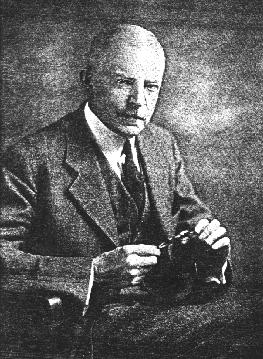
by Waldemar Lindgren
Sumpter and Cracker Creek Districts
--Placer Deposits--

The Sumpter placer mines were discovered in 1862, and have been worked more or less actively since that time. The first area of placers begins a short distance below Sumpter and extends up to the point where the Cracker Creek vein system cuts across the creek. Another mining district, the placers of which are mentioned under the heading "Minersville district," is situated on Deer Creek a few miles east of Sumpter. Several of the smaller creeks north of Minersville draining the western side of the Elkhorn Range and emptying into Deer Creek also contain placer gold. Placers have also been worked in several gulches above Sumpter and tributary to Powder River, such as Buck Gulch, Mammoth Gulch, and others.
The mining has been done largely by Chinese companies, and it is not believed that the diggings were very rich, compared with those of Auburn, Canyon, Mormon Basin, and similar places. It is impossible to ascertain the total output. At present the bench gravels are worked only in two places adjoining Sumpter---the Downie and Ellis mines. The annual yield of the Sumpter placers probably varies from $10,000 to $20,000. The present river bed, from 50 to 300 feet wide, and the low bars were worked during early days for a few miles above Sumpter, but the diggings are now abandoned. A short distance below Sumpter the gravels in the present bed contain fairly coarse gold, it is claimed, and the possibility of dredging has been suggested, though the depth is far to great to reach bed rock by such machinery. More detailed test must decide whether this is possible.
The gravels of most importance for present operations are the bench deposits, from 30 to 100 feet above the stream channel. These deposits connect directly with the Pliocene gravels skirting the base of the hills all around Sumpter Valley. Near Sumpter the auriferous veins above have enriched them sufficiently to make them available for placer work. Between Sumpter and McEwen's many shallow gulches cut in these gravels have been profitably mined. Sumpter itself stands on these bench gravels, which have a depth of 15 feet or more. At the electric-light plant a shaft was sunk 80 feet through sandy strata with two streaks of gravel which prospected well. Bed rock was not reached. The old channel probably underlies the bench gravels on the northeast side of the river, and from all indications it had a steeper grade than the present river. Most of the bench gravels lie on the narrow point opposite the town, between Cracker Creek and McCully Fork, on which the gravels reach a height 60 feet above the stream. The junction of two forks is here evident. The Pliocene equivalent of Cracker Creek is covered by the 200 acres of the Ellis mine, the principal workings of which are north of the Granite road where it crosses the gravel point. Several acres have here been hydraulicked, the banks being up to 80 feet high. The well washed gravels, fairly coarse, contain the rocks which crop above. The gold occurs in medium fine particles and the yield is reported as up to 16 cents per cubic yard. The bed rock is not exposed until a few hundred yards above Sumpter, where the large gravel areas dwindle into small benches lining the banks of Cracker Creek. A considerable amount of gravel remains, though much of it is not accessible without elevators, on account of lack of grade. The water is supplied by ditches aggregating 10 miles and carrrying 1,000 miner's inches. In past years these diggings have been leased to Chinese companies.
The Downie placer mines, 1 1/2 miles from Sumpter, are working on gravels representing the Pliocene McCully Fork, and comprose about 140 acres. The Downie channel is higher than the one just described, and forms a distinct depression on the east side of the creek The trough is 200 feet wide and contains well-washed gravel 50 feet deep. The bed rock is 40 feet above the present creek. Going downstream, the bed rock descends rapidly, and where the Granite road crosses the point between the forks, mentioned above, no bed rock is seen. The mines dispose of a good supply of water from 6 miles of ditches, carrying 1,000 miner's inches. Operations can be carried on until late in the fall. Two giants are usually operated by Chinese leasers, and the annual yield is reported to be about $9,000.
Rich placers with coarse gold are located in Buck Gulch, a tributary to McCully Fork, near the Granite road and 4 1/2 miles from Sumpter, scarcity of water restricts the operations.
These stories are available to our electronic readers as part of our contribution to the information available on the Internet. We're interested in hearing from you especially if you've been to Eastern Oregon, the Wallowas, the Blues, or if you know of Prof. Lindgren and his trips to the many other gold camps in the West. These stories are available to our electronic readers as part of our contribution to the information available on the Internet. We hope you enjoy the stories and if you have questions or comments please send a message to editor, Keith Whittle
More on Waldemar Lindgren:
[Editor's Introduction | "Gold Belt of Eastern Oregon"]Read our other gold mining editions:
[Sumpter, Oregon 1900 | Gold Seekers Rush to California]
[ Oregon: Land of Gold & Opportunity | Dequille Reports from the Comstock]

Bridget E. Smith, editor & publisher
Email | Home Page | Historic Headlines
Historical Gazette
Published in Portland, Oregon
© 1991-

