August to December 1900
Excerpted from USGS Reports
The Gold Belt of the Blue Mountains
of Oregon
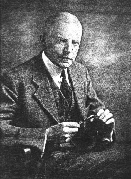
by Waldemar Lindgren
Granite District
--Placer Deposits--
The placers of Granite have been worked since 1862, but were scarcely as rich as those of other celebrated districts. A large part of the mining has been done by Chinese. In 1870 there were 40 white men and 200 Chinese in this district (Raymonds's Report, 1870}. The production is not mentioned. In 1882 the Granite placers produced $20,000, in 1889 $20,000, in 1891 $8,500, in 1892 $28,800 {Mint reports}. The present placer production is apparently fairly steady, a number of small mines having been worked for many years with constant output. The total output does not exceed $20,000 per annum.
The gravels in the stream beds of Granite Creek, Bull Run, and Clear Creek have been worked, chiefly by Chinese, for several miles above Granite: and below that place Granite Creek has also been worked. The gravels averaged 9 feet deep and from 50 to 300 feet across. Low gravel bars 30 feet above the river were also washed. Work on these gravels ceased about ten years ago.
The North Fork of the John Day has been worked from a point 7 miles northwest of Granite, where Thornburg's placers are locateed, up to Klopp's placers, where the Grande Ronde road crosses the stream. But little gold was found above Klopp's. Thornburg's placers, which were not visited, have been worked steadily for many years, and with an annual output of several thousand dollars.
The Black Pine placers are situated on a small flat at an elevation of 4,800 feet, a mile below the Cougar mine. They have been worked recently on a small scale. The gravels, of coarse argillite cobbles, rest on a bed rock of volcanic breccia. Johnson placers, on Crane Flat, have been worked successfully for many years. A system of ditches and reservoirs supplies water for a long season. Two hydraulic giants are operated. The gravels are said to be unusually rich. The mines are situated a short distance north of the divide separating Granite Creek from the North Fork and at an elevation of 5,500 feet, 5 miles north of Granite. Going up the steep gulch in which the Magnolia mine is situated, one crosses a small basalt flow at the divide. From here down to the North Fork extends strongly contrasting, gently sloping ground with clayey and gravelly soil, covered with poor forest and a succussion of flats and meadows. The clays are covered by thin gravels, which are washed and which probably derive their gold from the Buffalo and Blue Ribbon veins, situated a short distance above on the main ridge.
Klopp's placers are situated on the North Fork, 2 miles north of Crane Flat, the river here having an elevation of 5,200 feet. These diggings have been worked for many years on a moderate scale and are said to have regularly produced from $3,000 to $6,000 per year. The deposit is certainly one of the most remarkable that has come under observation.
The clays and sands of Crane Flat continue down to the river and the workings extend in irregular pits up to 130 feet above the stream. There is, as a rule, no bed rock visible, though the sediments lean against a high western rim of diorite in which the river has eroded a narrow canyon; but in one place a projecting point of argillite laid bare by the hydaulic work appears in the diggings, and at another place a small knob of basalt occurred below the gravel. The pay dirt is a most peculiar mixture of sand, fine well-washed gravel, and heavy, partly rounded bowlders of granodiorite and diorite, and also of basalt and slate. The bowlders are irregulatly mixed in the clayey sand and the gravel, which rarely shows and stratification. In one place, howerer, strongly pronounced fluviatile bedding was noted in a bank of sand underlying 12 feet of heavy bowlders mixed with sand. The gold is well washed and generally fine. The gravels are not rich, but the gold seems equally distributed through the mass.
The explanation of this deposit is probably to be found in the daming of the river by Neocene basalt flows to a level of 5,500 feet, and a simultaneous accumulation of gravels in the basin thus produced. There does not seem to be any deep channel through which the North Fork could have found an outlet toward Granite Creek, but the clays and gravels probably do cover the auriferous channel of an old tributary to the North Fork coming down from the vicinity of La Bellview and Buffalo mines. To judge frrom the granitic bowlders so abundantly scattered over this deposit it seems probable that the moraine of the glacier which once filled the upper valley of the North Fork reached down to this elevation and that the Neocene deposit has been worked over by glacial agencies.
Throughout the upper drainage basin of Bull Run above Granite many observations show that, in this watershed also, a damming by basalt flows similar to that below Granite has taken place and that the whole basin once was a lake which received fine sediments and along the margin of which, during its highest stand and during its gradual recession by canyon-cutting, the streams deposited their auriferous gravels. The best evidence of this is found at the Griffith placer mine, located 6 miles northwest of Sumpter. The road from Sumpter to Granite passes over a low gap {elevation 5,800 feet} in the ridge separating Powder River from the Granite Creek drainage basin. Decending the slope toward Granite, one finds that the diorite of the dividing ridge soon disappears, and at an elevation of 5, 300 feet the gentle slopes and small flats are covered with a clayey material with scattered, well-washed gravel. Nearly all the gulches in this vicinity have been worked with more or less success. Two miles below the summit a road leads off to the north, crosses Beagle Creek, and ascends Canal Creek some distance. The latter contains a considerable ammount of auriferous gravel still available for placer work.
Griffiths Camp is situated a short distance above Canal Creek, at an elevation of 5,289 feet, or 860 feet above Sumpter. To the west rises the main dividing ridge of granodiorite, about 700 feet above the placers. About the mines there is gently slopong ground, a sort of an ill-defined bench, below which the ground falls rapidly toward Bull Run. The gravel forms a small body on the north slope above Canal Gulch and extends, apparently resting on the slope of the hill, for 1 1/4 miles in a northwesterly direction. Back of it is high bed rock, but in front the downward slope of the country is unbroken. A hydraulic pit about 1 acre in extent has been made in the high gravels, and a bank 40 feet high is exposed. The gravel is fairly fine, sandy, extremely well washed, and shows fluviatile stratification. On the bed rock lie coarser cobbles of slate and porphyry, also well washed. The continuation of this body in a northwesterly direction is not well exposed, but seems to lie on a slope, and the extent and depth are difficult to estimate. Although a part of the gravel doubtless rests on diorite, the portion exposed in the pit lies on well-stratified beds of clay, with coaly layers dipping 30 toward the main divide. Thirty feet of these clayey beds are exposed, resting on granitic bed rock. The gold in the gravels is fairly coarse, but it is not probable that the material is very rich, though it may well pay for washing. On the slopes below the deposit and in Canal Gulch the gold has been reconcentrated, and these gravels are much richer. A small area of basalt covers a hill rising 150 feet above the gravels and seems to directly overlie the latter.
The water supply is taken from Canal and Boundary creeks, on the western slope of Bald Mountain, the ditches aggregating 9 miles in length.
These stories are available to our electronic readers as part of our contribution to the information available on the Internet. We're interested in hearing from you especially if you've been to Eastern Oregon, the Wallowas, the Blues, or if you know of Prof. Lindgren and his trips to the many other gold camps in the West. These stories are available to our electronic readers as part of our contribution to the information available on the Internet. We hope you enjoy the stories and if you have questions or comments please send a message to editor, Keith Whittle
More on Waldemar Lindgren:
[Editor's Introduction | "Gold Belt of Eastern Oregon"]Read our other gold mining editions:
[Sumpter, Oregon 1900 | Gold Seekers Rush to California]
[ Oregon: Land of Gold & Opportunity | Dequille Reports from the Comstock]

Bridget E. Smith, editor & publisher
Email | Home Page | Historic Headlines
Historical Gazette
Published in Portland, Oregon
© 1991-