August to December 1900
Excerpted from USGS Reports
The Gold Belt of the Blue Mountains
of Oregon
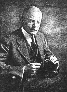
by Waldemar Lindgren
Susanville District
--Placer Deposits--

The well-known placer mines of Susanville were discovered in 1864 and have been worked every season since then. Elk Creek has been the greatest producer, but Deep Creek, 1 mile below Susanville, as well as Onion Creek and Big Creek, still farther down the river, have also yielded considerably. All of these producing creeks join the Middle Fork from the north side and descend from Greenhorn Mountains. The Middle Fork itself has been worked below Elk Creek and is reported to have produced $50,000 in fine flour gold. The production during the first four years after the discovery amounted to at least $80,000 (Raymond's report for 1870}.
The total production is probably in the vicinity of $600,000. During 1900 all the creeks were worked, at least for a short season. Chinese miners were at work on Elk Creek, 1 mile above the town, with hydraulic apparatus and derricks. Drifting operations were in progress on Big Creek, 8 miles from the river. Of the creeks emptying into the river from the south, Bear Creek, 1 mile below Susanville, is being worked, and some gravel is being washed at the head of Camp Creek.
The placers of Susanville contain coarse gold of a fineness of 865; a nugget worth $480 was found on Elk Creek, another worth $625 on Deep Creek, while Buck Gulch, below Deep Creek, holds the record with an $800 nugget. Cinnabar in rounded masses up to 3 or 4 inches in diameter, intergrown with normal vein quartz, is of common occurrence on Elk Creek, but has not yet been found in place. Elk Creek has been worked continuously for about 2 1/2 miles above its mouth. Eight miles above the mouth, at Elk City, some placer work has also been done. The pay seemed to be derived from the west side of the creek, the east fork being barren, and sometimes the gold may be traced up the hill to the quartz veins from which it was derived. These appear generally to have been narrow and of a pockety nature. The gravel is coarse and contains many bowlders of greenstone, which must be handled with derricks. Usually the bottom of the creek is level and 100 feet wide. It contains two or three channels or gutters, the rims of which were raised 1 to 3 feet above the bottom . These gutters practically contain all the gold. The bottom of the creek is filled 10 to 20 feet deep with gravels. It has been stated above that some placer work has been done on the Middle Fork. This stream flows in a gravel-filled channel in places as much as several hundred yards wide, suitable for dredging, the depth to bed rock ordinarily being only 8 to 10 feet.
Prospecting operations for this purpose were carried on in 1898 between the mouth of Granite Boulder Creek, which is somewhat auriferous, and a point below Susanville. Many shafts were sunk, and it is believed that in favorable places along certain channels the gravels averaged 20 cents per yard.
These stories are available to our electronic readers as part of our contribution to the information available on the Internet. We're interested in hearing from you especially if you've been to Eastern Oregon, the Wallowas, the Blues, or if you know of Prof. Lindgren and his trips to the many other gold camps in the West. These stories are available to our electronic readers as part of our contribution to the information available on the Internet. We hope you enjoy the stories and if you have questions or comments please send a message to editor, Keith Whittle
More on Waldemar Lindgren:
[Editor's Introduction | "Gold Belt of Eastern Oregon"]Read our other gold mining editions:
[Sumpter, Oregon 1900 | Gold Seekers Rush to California]
[ Oregon: Land of Gold & Opportunity | Dequille Reports from the Comstock]

Bridget E. Smith, editor & publisher
Email | Home Page | Historic Headlines
Historical Gazette
Published in Portland, Oregon
© 1991-

